Space Sensors
Sensors are vital tools for collecting data about Earth and atmospheric processes. They can be installed on satellites, aircraft, or directly on the ground. There are two main types of sensors: active and passive. Active sensors generate their own energy to detect objects, while passive sensors capture energy emitted or reflected from the environment.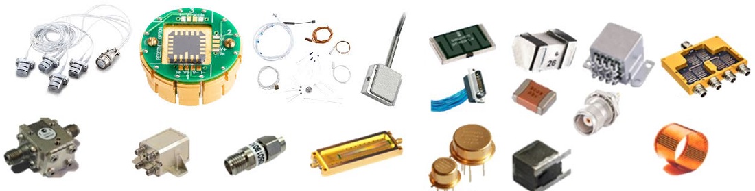
The space industry has long been a leader in innovation, with sensors playing a crucial role in gathering critical data, enhancing safety, and driving discoveries. Whether for launch vehicles, satellites, or orbiting modules, space-qualified sensors are trusted by leading spaceflight companies worldwide. These sensors undergo rigorous testing to meet the demands of space missions, where failure is not an option.
Sensors monitor space objects, detect potential hazards like solar flares or meteorites, and track position changes. Remote sensing, for instance, uses both active and passive sensors to observe distant objects. Active sensors, such as radar and LiDAR, emit energy to detect targets, while passive sensors rely on naturally emitted or reflected energy.
For over 30 years, thin film pressure transducers have been integral to space exploration, known for their long-term reliability. These devices use a state-of-the-art sensor bridge, ensuring accurate measurements under harsh conditions. Space-qualified transducers are customizable, making them suitable for a wide range of missions.
Pressure sensors and other instruments, like accelerometers and magnetic sensors, are used to measure temperature, monitor spacecraft health, and provide critical data for navigation and exploration. Remote sensing continues to be a key technology in space, enabling scientists to study celestial bodies and gather valuable information about the universe.
Here are some common sensors used in space applications:
- Accumulation Radar (AR): Provides high-resolution profiles of ice surfaces.
- Advanced Baseline Imager (ABI): Primary instrument on the GOES-R Series for imaging Earth’s weather, oceans, and environment.
- Advanced Himawari Imager (AHI): Enhances weather forecasting and environmental monitoring.
- Advanced Microwave Precipitation Radiometer (AMPR): Detects precipitation-size ice, liquid water, and water vapor.
- Advanced Microwave Radiometer (AMR-2): Measures atmospheric water vapor and liquid water content.
- Advanced Microwave Radiometer for Climate (AMR-C): A radar altimeter measuring sea-surface height.
- Advanced Microwave Scanning Radiometer 2 (AMSR2): Gathers global data on precipitation, ocean winds, water vapor, sea ice, and soil moisture.
- Advanced Spaceborne Thermal Emission and Reflection Radiometer (ASTER): Captures high-resolution images in 14 electromagnetic wavelengths.
- Advanced Technology Microwave Sounder (ATMS): Provides global profiles of temperature and moisture.
- Advanced Topographic Laser Altimeter System (ATLAS): Measures elevation changes, including shallow water features.
- Advanced Very High Resolution Radiometer (AVHRR): Monitors surface temperature, snow/ice cover, soil moisture, and vegetation.
- Airborne Topographic Mapper (ATM): Scanning laser altimeter measuring ice surface elevation.
- Airborne Visible InfraRed Imaging Spectrometer (AVIRIS): Identifies and monitors Earth’s surface and atmosphere through molecular signatures.
- Atmospheric Infrared Sounder (AIRS): Gathers global water vapor and temperature data daily.
- Cloud Profiling Radar (CPR): Measures cloud density and altitude.
- Cloud-Aerosol Lidar with Orthogonal Polarization (CALIOP): Provides vertical profiles of aerosols and clouds.
- Clouds and the Earth’s Radiant Energy System (CERES): Measures reflected solar and infrared radiation.
- Cross-track Infrared Sounder (CrIS): Collects global temperature and moisture profiles.
- Delay Doppler Mapping Instrument (DDMI): Measures ocean wind speed.
- Digital Mapping System (DMS): Airborne digital camera system that maps terrain images.
- Dual-frequency Precipitation Radar (DPR): Measures mid-latitude rainfall and snowfall.
- Earth Polychromatic Imaging Camera (EPIC): Provides color images of Earth from deep space.
- Earth Surface Mineral Dust Source Investigation (EMIT): Measures light emitted by minerals to study desert dust.
- Enhanced Thematic Mapper Plus (ETM+): High-resolution, multispectral Earth imaging.
- Geoscience Laser Altimeter System (GLAS): Provided data on ice mass, topography, and cloud properties.
- Global Ecosystem Dynamics Investigation (GEDI): Measures 3D structure of Earth’s surface.
- Gravity Recovery and Climate Experiment (GRACE): Tracks changes in Earth’s gravity field.
- High Altitude MMIC Sounding Radiometer (HAMSR): Analyzes atmospheric temperature and density.
- High-Resolution Dynamics Limb Sounder (HIRDLS): Measured atmospheric properties in the troposphere and stratosphere.
- Microwave Limb Sounder (MLS): Senses atmospheric gases, temperature, pressure, and cloud ice.
- Moderate-Resolution Imaging Spectroradiometer (MODIS): Provides global data for a wide range of Earth sciences.
- NASA-ISRO Synthetic Aperture Radar (NISAR): Side-looking radar for land and environmental monitoring.
- Ozone Mapping and Profiler Suite (OMPS): Tracks the health of Earth’s ozone layer.
- Precipitation Radar (PR): Measured 3D rainfall distribution over land and ocean.
- Tropospheric Emission Spectrometer (TES): An infrared sensor measuring tropospheric gases.
- Visible Infrared Imaging Radiometer Suite (VIIRS): Collects data on Earth’s land, atmosphere, and ocean.
These sensors contribute to a broad spectrum of environmental, atmospheric, and oceanographic studies.
